🛰️ Satellites and AI revolutionize wildfire detection in the FireSat project - now in use in California, British Columbia and Australia
Thank you for choosing Automatic Translation. Currently we are offering translations from English into French and German, with more translation languages to be added in the near future. Please be aware that these translations are generated by a third party AI software service. While we have found that the translations are mostly correct, they may not be perfect in every case. To ensure the information you read is correct, please refer to the original article in English. If you find an error in a translation which you would like to bring to our attention, it would help us greatly if you let us know. We can correct any text or section, once we are aware of it. Please do not hesitate to contact our webmaster to let us know of any translation errors.
A new wave of wildfire detection technology is transforming how governments and emergency agencies respond to fast-moving fires.
According to CNN’s September 23, 2025 report, satellites equipped with thermal sensors and artificial intelligence are now capable of spotting wildfires within minutes of ignition—often before they’re visible to the human eye.
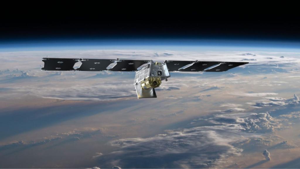
The Earth Fire Alliance, a global nonprofit, has partnered with Muon Space and Google to launch FireSat — the world’s first fleet of more than 50 satellites designed to scan the entire planet in near real time for signs of wildfire.
Using AI to analyze the data, FireSat will deliver almost continuous intelligence to responders worldwide, transforming how communities confront these devastating fires.
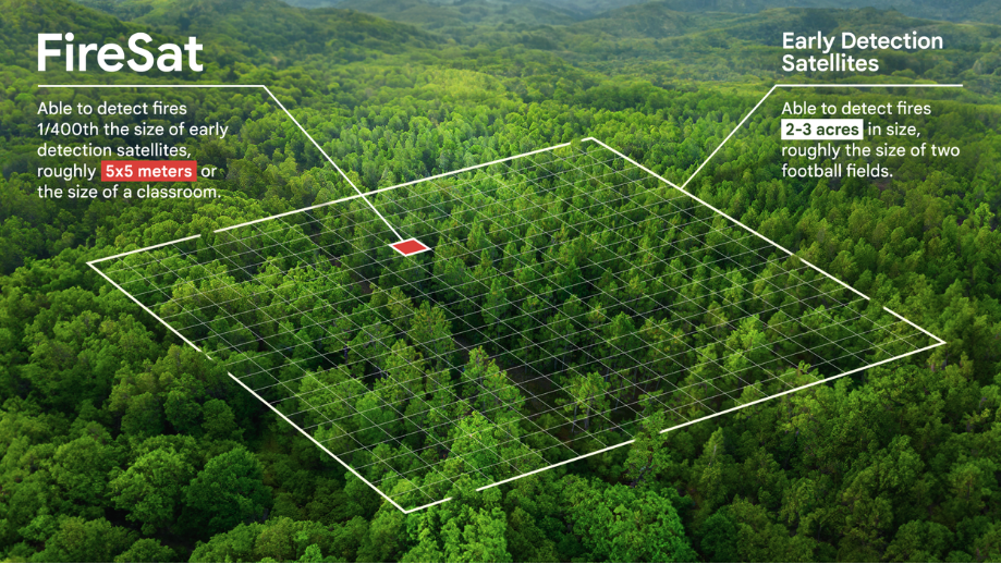
Photo Credit:
Artist's illustration of a satellite built by Muon Space. Credit: Muon Space
🔍 How It Works
- Thermal Imaging Satellites: These orbiting platforms scan vast landscapes for heat anomalies, detecting even small flare-ups in remote areas.
- AI Algorithms: Once a heat signature is identified, AI systems analyze patterns to distinguish wildfires from industrial heat sources or solar reflections.
- Real-Time Alerts: The data is transmitted to ground stations and emergency response centers, triggering alerts that can mobilize firefighting crews faster than ever before.
🌲 Impact on Emergency Response
This technology is already being piloted in California, British Columbia, and parts of Australia. In some cases, fires have been detected and contained within hours—dramatically reducing damage and evacuation needs.
CNN’s report highlights how private companies and public agencies are collaborating to expand satellite coverage and improve AI accuracy. The goal is to build a global early-warning system that can detect wildfires anywhere on Earth within minutes.
Read more:
https://www.cnn.com/2025/09/23/business/video/satellites-ai-wildfire-detection-spc-digvid
https://www.eoportal.org/satellite-missions/ororatech-wildfire-constellation
https://viterbischool.usc.edu/news/2025/03/detecting-wildfires-with-ai/
https://yorkshireanalysis.com/ai-powered-wildfire-detection/
https://firms.modaps.eosdis.nasa.gov/map/